Northeast Ohio is part of the glaciated Allegheny Plateau physiographic region. Landscapes in this region range from relatively flat to hilly and dissected. It is a transitional area between the Central Midwest and Northeastern U.S. The current forests of this region developed on glacial features present since the retreat of glaciers nearly 12,000 years ago. More recently, human land use changes have driven the establishment of younger, ruderal forest stands on land previously cleared for agriculture or urban/suburban development. The introduction of non-native species as well as effects from forest pests and pathogens have altered the composition of many forested areas, sometimes dramatically. The main forest communities of the region are represented in the six major types described here and based on data collected as part of an extensive long-term plant community assessment program established throughout Cleveland Metroparks. These descriptions are loosely based on the U.S. National Vegetation Classification (USNVC) system.
Included with each community description is a list of the dominant tree species characteristic of each forest type. The “Where to Find” section at the bottom of the page will link you to recommended trails to explore these forest communities within Cleveland Metroparks.
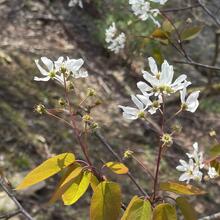
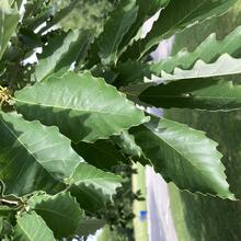
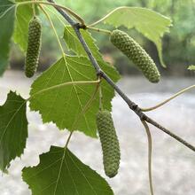
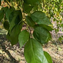
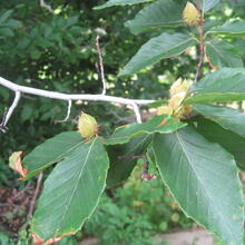
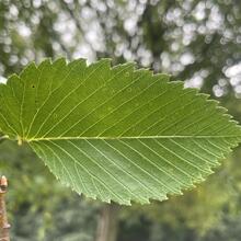
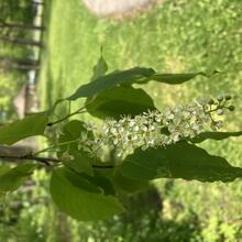
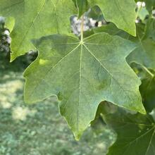
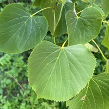
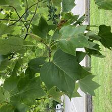
This forest is dominated by long-lived, mesic species that form multi-layered uneven-aged stands. Stands occur on flat to rolling topography with soils ranging from sands to loams. Those with a significant amount of eastern hemlock (Tsuga canadensis) are often found in ravines or low cool sites, on a variety of primarily mesic soils. Canopy dynamics are dominated by single and multiple disturbances, encouraging gap phase regeneration through small to medium blowdown events. Larger disturbances include windthrow, insect attacks and ice storms. Many northern hardwoods species including such as American beech (Fagus grandifolia), sugar maple (Acer saccharum), tulip poplar (Lireodendron tulipifera), red oak (Quercus rubra), red maple (Acer rubrum), and wild black cherry (Prunus serotina), form the deciduous canopy. Other species including basswood (Tilia americana), yellow birch (Betula alleghaniensis), sweet birch (Betula lenta) or American hophornbeam (Ostrya virginiana) may be associates. Some are mixed with evergreens of eastern hemlock (Tsuga canadensis) or in some cases white pine (Pinus strobus). The canopy formed by the overstory trees and smaller saplings greatly reduces the amount of light that reaches lower vegetation strata.
Dominant Tree Species
Where To Find
Location:
Location:
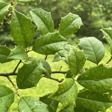
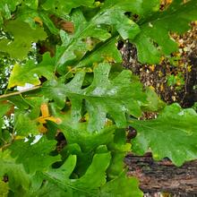
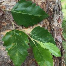
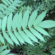
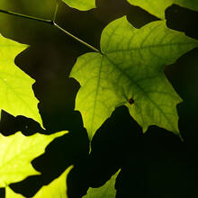
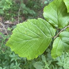
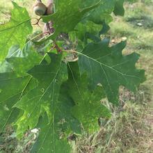
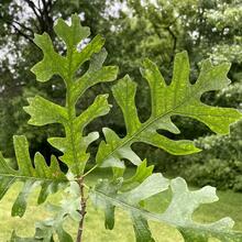
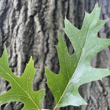
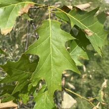
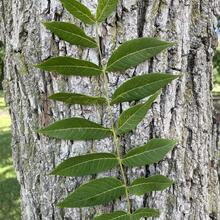
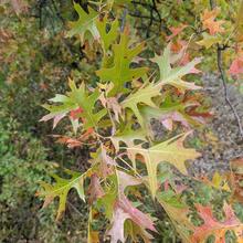
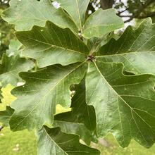
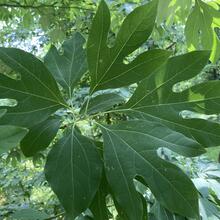
This forest is found throughout the glaciated region on gently rolling to dissected landscapes. Historically, this type was quite extensive across the Midwest. It can occur on uplands or on rolling glacial moraines, among kettle-kame topography, and outwash plains. It is distinguished from other forested groups by a dry-mesic to dry soil condition that is transitional between dry prairies, or oak savannas and mesic hardwood forests. Soils are typically well-drained to excessively drained and range from loamy to sandy in texture. Local areas of calcareous bedrock may support forests typical of richer soils. Forest cover can range from a dense to moderately open canopy of deciduous broadleaf trees and there is commonly a dense shrub layer. Fire-resistant oak species, in particular white (Quercus alba), red (Quercus rubra), and/or black (Quercus velutina), dominate the overstory. Hickories such as pignut (Carya glabra), shagbark (Carya ovata), bitternut (Carya cordiformis), and mockernut (Carya tomentosa) are characteristic associates.
Dominant Tree Species
Where To Find
Location:
Location:
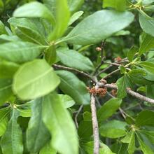
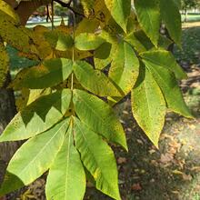
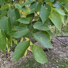
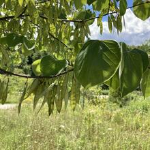
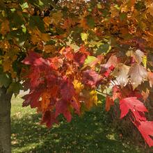
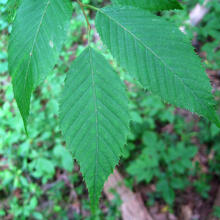
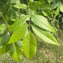
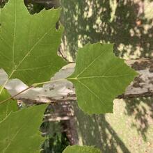
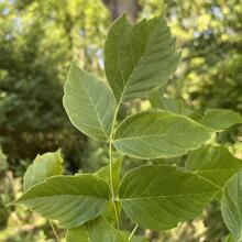
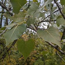
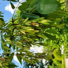
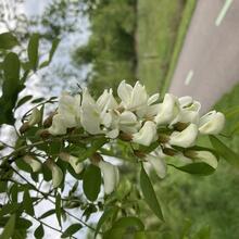
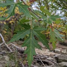
These floodplain forests are found throughout the central United States. They can occur on sloping ridges, terraces, natural levees, or higher elevations that border rivers or streams. Examples occur on well-drained to poorly drained alluvial soils ranging from sands to clay. Sites are infrequently to frequently flooded with many examples affected by disturbance such as development, or agricultural resulting in large changes in the hydrologic regime. Stands are typically dominated by broad-leaved deciduous trees with a closed to moderately open canopy. Dominants include a combination of green ash (Fraxinus pennsylvanica), American sycamore (Platanus occidentalis), cottonwood (Populus deltoides), various maple species, silver (Acer saccharinum) and red (Acer rubrum). Historically disturbed sites often support early-successional native species adapted to wet conditions, especially box elder (Acer negundo) and red maple (Acer rubrum) and willow (Salix spp.). The understory of is commonly invaded by exotic or invasive shrub and herbaceous species.
Dominant Tree Species
Where To Find
Location:
Location:
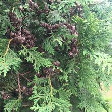
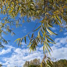
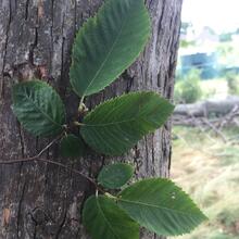
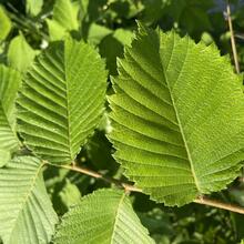
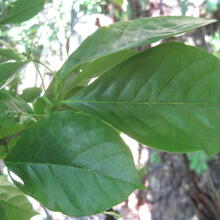
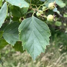
These are forested wetlands that occupy primarily non-alluvial flats and depressions where drainage is poor. Landscape swales and changes in micro-topography may result in areas with or without standing water depending on precipitation. Therefore, species may be partitioned or establish in different zones depending on hydroperiod. Red maple (Acer rubrum) is often a dominant component, particularly in younger, more ruderal examples. While oak species, including swamp white oak (Quercus bicolor) and pin oak (Quercus palustris) can be common and dominate the more mature forest canopy, other species often present may include a combination of silver maple (Acer saccharinum), green ash (Fraxinus pennsylvanica), black gum (Nyssa sylvatica), or American elm (Ulmus americana). Buttonbush (Cephalanthus occidentalis) is a typical shrub component in areas with a longer hydroperiod. The herbaceous layer is widely variable depending on geography and hydroperiod. Understory shrub and herbaceous species vary with moisture level and canopy density. Erratic fluctuations to flooding, or drought can impact this community.
Dominant Tree Species
Where To Find
Location:
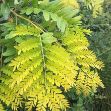
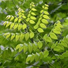
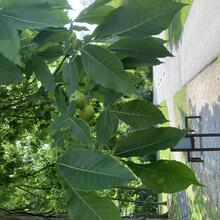
These younger forests can be found scattered across the region as early successional stands often associated with more recent disturbance events, transition zones, edges, or restoration sites. Rather than dominance by a particular tree species, ruderal forests are instead characterized as having high stem density. These heavily dense forests will be dominated by either small sized trees or larger sized trees depending on time since the last major disturbance event. Typically, tree species with wing dispersed seed, fast growth rates, and/or those with close mature trees in proximity will colonize a site first and rapidly establish. Therefore, species composition can be highly variable and often includes many of the species that also characterize the other forest types, albeit, in somewhat unpredictable quantities and combinations.
Dominant Tree Species
Where To Find
Location:
Location:
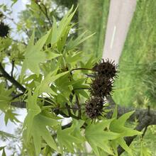
This cover type is found throughout the region near urban or developed landscapes. Their occurrence is not typical of natural communities and is instead a result of highly variable managed landscapes including street trees, landscape or yard plantings, small-scale pocket parks, or vacant land. Natural soil conditions have likely been altered due to heavy land-use history and development resulting in urban soil classification where a loss of topsoil and compaction are common. The wide range of existing tree species (native and exotic) reflect the manipulated landscape as either intentional plantings or unintentional establishment and thus no tree is ‘typical’ for this cover type. However, the dominant trees listed below represent those Ohio native tree species that are currently found in our urban environments or those that have a relatively higher tolerance to urban stress.